Back Gallatin National Forest CEB Gallatin National Forest German Bosque nacional de Gallatin Spanish Forêt nationale de Gallatin French Foresta nazionale di Gallatin Italian 加勒廷国家森林 Chinese
| Gallatin National Forest | |
|---|---|
 | |
| Location | Montana, United States |
| Nearest city | Bozeman, Montana |
| Coordinates | 45°16′21″N 110°22′06″W / 45.27250°N 110.36833°W |
| Area | 2,129,194 acres (8,616.54 km2)[1] |
| Established | February 10, 1899[2] |
| Governing body | U.S. Forest Service |
| Website | Custer-Gallatin National Forest |
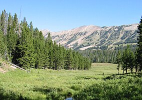
The Gallatin National Forest (now known as the Custer-Gallatin National Forest) is a United States National Forest located in South-West Montana. Most of the Custer-Gallatin goes along the state's southern border, with some of it a part of North-West Wyoming.
- ^ "Land Areas of the National Forest System" (PDF). U.S. Forest Service. October 2021. Retrieved May 24, 2022.
- ^ "The National Forests of the United States" (PDF). U.S. Forest Service. Archived from the original (PDF) on October 28, 2012. Retrieved June 25, 2012.

